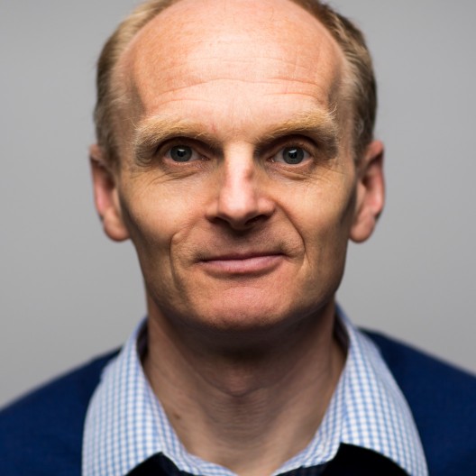
William Wilcock
· OceanographyVerifiedUniversity of Washington · Program on the Environment
Active 1990–2026
About
William Wilcock, the Jerome M. Paros Endowed Chair in Sensor Networks, is a marine geophysicist who uses earthquake recordings, seismic imaging, and modeling techniques to study seafloor volcanoes and hydrothermal systems. He is the inaugural director of the Paros Geohazards Center at the University of Washington. His efforts include developing and deploying geodetic and seismic instruments on the seafloor along the Cascadia subduction zone to understand and mitigate the region’s seismic hazards. In addition to his work in geophysics, William studies baleen whales by analyzing opportunistic recordings of their subsonic calls captured by ocean bottom seismometers.
Research topics
- Computer Science
- Geology
- Oceanography
- Seismology
- Environmental science
- Telecommunications
- Engineering
- Library science
- Fishery
- Art history
- Acoustics
- Archaeology
- Remote sensing
- Environmental resource management
- History
Selected publications
Geochemistry Geophysics Geosystems · 2026-02-01
articleOpen accessAbstract Back‐arc basins provide insights into the processes governing the evolution of continental rifting to seafloor spreading. The Bransfield basin hosts a back arc rift that is hypothesized to be in the late stages of this transition. Orca volcano is a submarine volcano that lies on the most evolved portion of the rift. It coincides with a transition in the rifting style from a clearly delineated magmatic rift to the southwest to a wide and deeper faulted graben with thicker sediment to the northeast. We conducted an active‐source tomography experiment to image the three‐dimensional isotropic and anisotropic P‐wave velocity structures of the upper‐crust of Orca Volcano. We developed a method to incorporate secondary arrivals to improve the imaging of the volcano's magma chamber. The magma chamber extends from ∼1 km beneath the seafloor to 3–4 km depth with a maximum melt fraction of 16%–41% and a melt volume of 0.8–2.3 km 3 . The southwest rift of Orca volcano is characterized by a narrow zone of low velocities that connects to the magma chamber and by strong rift parallel anisotropy at shallow depths. Its structure has similarities to a slow spreading ridge consistent with a rift that is transitioning to seafloor spreading. Extension to the northeast of Orca is more distributed and not clearly linked to the volcano. We infer that the change in extensional style results from a more hydrated and weaker mantle to the northeast that may be caused by a tear in the Phoenix slab and a consequent change in slab depth.
Geology · 2026-03-19
articleSenior authorThe traditional view that volcanoes are underlain by a single, melt-dominated magma chamber has recently evolved into the idea that subsurface melt is heterogeneously distributed in a larger magma domain. While seismic imaging of small melt bodies beneath subaerial volcanoes remains difficult, melt bodies located several kilometers from mid-ocean ridge axes and submarine volcanic edifices have been identified. Nevertheless, the connectivity of these melt bodies within the magma domain and their role during eruptions remain unclear. We analyzed continuous ocean-bottom seismic data recorded in 2015−2025 CE that detected 415 volcanic tremor episodes that emerged ∼60 h before, and continued during, the 2015 Axial Seamount eruption. The volcanic tremors initiated ∼19 km southeast of the caldera before migrating into it and showed spatial overlap with funnel-shaped axial melt lenses and/or lithosphere-asthenosphere boundaries. Our results suggest that these volcanic tremors reflect the activation of or transport through distributed melt bodies over 10 km from the caldera, which provided enhanced magma supply for Axial Seamount’s eruption and highlight a broader interconnected active magma plumbing system where melt can be mobilized within a matter of days for an eruption.
Classifying accuracy of fin whale range estimates from single seismic sensors
The Journal of the Acoustical Society of America · 2026-02-01
articleOcean-bottom seismometers (OBSs) are used increasingly often to track baleen whale signals, employing single-station ranging techniques such as the three-component (3C) method. By using the orientation of ground motion from OBS components, the 3C method provides robust range estimates of direct-path signals within a validity range that relates to instrument depth. Consequently, the method requires a classification process to determine whether a signal falls within the validity range. Fin whale tracks, composed of 20-Hz notes from six locations, were used to develop and evaluate three classification models: decision trees (DTs), generalized additive models, and neural networks. Models were trained using different data combinations and incorporated a comprehensive set of variables related to channel amplitude, signal quality, polarization, and estimated signal angles. The DT achieved the highest performance, reaching an accuracy of 0.94 on the test data. Key variables for predicting the validity of the 3C ranges included the difference between observed horizontal-to-vertical amplitude ratios and its theoretical value, polarization metrics, and the amplitude of one horizontally oriented OBS component (Y-channel). The resulting framework contributes to improving the utility of seismic data for biological studies, which are critical for marine mammal monitoring and conservation strategies.
Active protothrusts and fluid highways: Seismic noise reveals hidden subduction dynamics in Cascadia
Science Advances · 2026-02-27
articleOpen accessComplex interactions between strain accumulation, fault slip, and fluid migration influence shallow subduction zone dynamics. Using a decade of continuous ambient seismic data from Cascadia's seafloor observatories, we identified distinct regional variations in subduction dynamics. Northern Cascadia exhibits a fully locked megathrust with persistent strain accumulation, while central Cascadia displays a slow slip event on protothrusts and rapid fluid migration along fault systems in the overriding plate. Effective fluid transport through the décollement and the Alvin Canyon Fault likely modulates the earthquake behavior but does not cause slow slip events on the megathrust and likely stabilizes large earthquakes, promoting rupture arrest.
2026-03-14
articleOpen accessCorrespondingSeafloor quartz-resonant pressure gauges manufactured by Paroscientific have long been used to measure vertical seafloor deformation, yet the gauge-specific drift characteristics continue to hinder the precise identification of geodetic and oceanic signals. Recent self-calibrating pressure gauge designs address this limitation by housing an internal reference pressure standard that can be isolated from ambient seawater. Scheduled valve operations switch between ambient and reference pressures, thereby enabling in situ drift calibrations that are isolated from oceanographic variability and seafloor deformation. We evaluate four designs of self-calibrating pressure gauges. The University of Washington (UW) A-0-A, commercial Sonardyne Fetch AZA, and commercial RBR BPRzero use the internal pressure of the instrument housing, measured by a barometer, as a reference. In contrast, the Scripps Institution of Oceanography Cabled Self-Calibrating Pressure Recorder (CSCPR) uses a piston-cylinder system to generate a controlled reference pressure near ambient pressure reading. A-0-A, Fetch AZA, and CSCPR instruments are deployed at 1500 m depth on Axial Seamount at the Central Caldera site of the Ocean Observatories Initiative Regional Cabled Array. Additionally, a Fetch AZA is deployed at 400 m depth on the Barkley Canyon, and a BPRzero is deployed at 2200 m depth on the Endeavour segment on the Ocean Networks Canada NEPTUNE cabled observatory. At Axial Seamount, the instruments are within 50 m of one another and are adjacent to a conventional pressure gauge in a bottom pressure and tilt (BOTPT) instrument that has been deployed since 2014 and is well aged, with a small drift rate inferred from repeated mobile pressure recorder surveys. Assuming ocean-derived pressure fluctuations and volcanic deformation are spatially coherent across all sensors, each self-calibrating gauge is evaluated by (i) comparing its data with the BOTPT and other gauges to quantify post-calibration residuals, and (ii) assessing internal consistency for the UW A-0-A and CSCPR, which have two pressure gauges inside each unit. Our comparison shows that the self-calibrating pressure gauges generally agree within ±1.0 hPa/year (or 1.0 cm/year of water column height change) over multiple years of deployment. The one exception is the UW A-0-A system. Early in two deployments (2019-2022 and 2024-present), its two gauges are inconsistent with one another and other instruments by up to several hPa, but this bias diminishes within a year, and the records converge. We are evaluating the cause of this transient behavior by analyzing A-0-A calibration sequences. At Barkley Canyon and the Endeavour segment, we evaluate Fetch AZA and BPRzero in the same manner as at Axial Seamount, using several co-sited gauges within 3 km. Both commercial gauges agree with the independent co-sited gauge within ±1.0 hPa/year after applying drift corrections. Comparing data from co-sited sensors enables us to investigate the subtle features of each sensor's performance. All designs demonstrate the potential to reduce instrumental drift to less than 1.0 cm/year. Further evaluation across a wider range of ambient conditions and deployment configurations is warranted.
2025-02-12
preprintBack-arc basins provide insights into the processes governing the evolution of continental rifting to seafloor spreading. The Bransfield basin hosts a back arc rift that is hypothesized to be in the late stages of this transition. Orca volcano is a submarine volcano that lies on the most evolved portion of the rift. It coincides with a transition in rifting style from a clearly delineated magmatic rift to the southwest to a wide and deeper faulted graben with thicker sediment to the northeast. We conducted an active source tomography experiment to image the three-dimensional isotropic and anisotropic P-wave velocity structure of the upper-crust of Orca Volcano. We developed a method to incorporate secondary arrivals to improve the imaging of the volcano’s magma chamber. The magma chamber extends from ~1 km beneath the seafloor to 3-4 km depth with a maximum melt fraction of 16-41% and melt volume of 0.8-2.3 km3. The southwest rift of Orca volcano is characterized by a narrow zone of low velocities that connects to the magma chamber and by strong rift parallel anisotropy at shallow depths. Its structure is similar to a slow spreading ridge consistent with a rift that is transitioning to seafloor spreading. Extension to the northeast of Orca is more distributed and not clearly linked to the volcano. We infer that the change in extensional style results from a more hydrated and weaker mantle to the northeast that is caused by a tear in the Phoenix slab and a consequent change in slab depth.
Active Protothrusts and Fluid Highways: Seismic Noise Reveals Hidden Subduction Dynamics in Cascadia
ArXiv.org · 2025-05-21
preprintOpen accessComplex interactions between strain accumulation, fault slip, and fluid migration influence shallow subduction zone dynamics. Using a decade of continuous ambient seismic data from Cascadia seafloor observatories, we identified distinct regional variations in subduction dynamics. Northern Cascadia exhibits a fully locked megathrust with persistent strain accumulation, while central Cascadia displays a slow slip event on protothrusts and rapid fluid migration along fault systems in the overriding plate. Effective fluid transport through the decollement and the Alvin Canyon Fault likely modulates the earthquake behavior but does not cause slow slip events on the megathrust and likely stabilizes large earthquakes, promoting rupture arrest.
The Cascadia Offshore Subduction Zone Observatory Infrastructure Project
2025-12-17
article1st authorCorrespondingThe Cascadia Offshore Subduction Zone Observatory (COSZO) is an NSF-funded Mid-scale Research Infrastructure-1 Project that will add seismic and geodetic instrumentation in summer 2026 to the Ocean Observatories Initiative (OOI) Regional Cabled Array (RCA) off Newport, Oregon. In Cascadia, geophysical observations indicate that the megathrust is mostly locked from the coastline to the deformation front, but off central Oregon they are consistent with a locked megathrust near the deformation front that transitions to creeping behavior beneath the shelf where there are two sustained clusters of earthquakes. To enable COSZO, we have updated the design of the RCA science junction boxes to eliminate obsolete components and new junction boxes are being constructed to connect to three primary nodes on the continental slope and shelf that currently do not support seafloor geophysical observations. At each new junction box and fourth site on the shelf, we will install a Nanometrics Atlantis Cabled Observatory ocean bottom seismic package which comprises a buried broadband seismometer and strong motion accelerometer, a low-frequency hydrophone and a differential pressure gauge. We are building two types of calibrated pressure gauges that utilize Paroscientific resonant quartz crystal sensors. The Geodetic and Seismic Sensor Module combines a triaxial accelerometer with two absolute pressure guages that are periodically calibrated against the internal pressure of the housing measured by a barometer. The Cabled Self Calibrating Pressure Recorder also includes two absolute pressure gauges but performs calibrations with a reference pressure close to ambient generated by a piston gauge. COSZO will also include uncalibrated absolute pressure gauges and Nortec Vektor 3-component ocean current meters. Together with sensors already on the OOI RCA at the Slope Base and Hydrate Ridge sites, the infrastructure will enable studies of fault coupling and transient fault slip of the Cascadia megathrust and the overlying accretionary prism and support efforts to prototype offshore earthquake and tsunami early warning. COSZO is also implementing procedures to stream data into Earthscope Data Services and the data storage system used by the RCA for added instruments.
Possible Shallow Tectonic Tremor Signals Near the Deformation Front in Central Cascadia
Seismica · 2025-08-19 · 1 citations
articleOpen accessTo better constrain the locking state of the shallow Cascadia megathrust, we investigate whether shallow tectonic tremor occurs near the deformation front at ~44.5°N during 2015-2024. We focus on two cabled buried ocean bottom seismometers (OBSs) on the portion of Cascadia that has evidence of partial locking offshore: one at Slope Base on the incoming plate ~5 km from the deformation front, and another ~20 km east on the overriding plate at Southern Hydrate Ridge. We first use in situ measured bottom currents to show that shallow burial successfully prevents current-generated noise on OBSs. We then develop a single-station approach to isolate tectonic tremor-like signals based on waveform and spectral characteristics. This technique allows the use of isolated stations and small networks and accounts for emergent signals specific to the marine environment, namely T-phases and ship noise. Application of this approach to the buried OBSs in central Cascadia detects tectonic tremor-like signals at the Slope Base site only that cannot easily be attributed to instrumental or environmental noise. Additional observations are required to verify the origin of these signals, but possible sources include localized slow slip on the décollement, protothrusts, faults on the incoming plate, nearby strike-slip faults, or deformation within the outermost accretionary wedge.
Enhancing fin whale vocalizations in distributed acoustic sensing data
The Journal of the Acoustical Society of America · 2025-05-01 · 4 citations
articleOpen accessDetecting and locating marine mammals is essential for understanding their behavior and supporting conservation efforts. Acoustic methods complement visual surveys and tagging, which are often limited in spatial and temporal coverage. Fin whales are particularly suited for acoustic monitoring due to their stereotypical 20 Hz vocalizations. Distributed Acoustic Sensing (DAS) offers a promising addition to hydrophone data, using fiber-optic cables as sensors for continuous, high-resolution monitoring over distances up to about 100 km. In November 2021, a DAS dataset was collected using the Ocean Observatories Initiative Regional Cabled Array, capturing valuable data on fin whale vocalizations. This dataset includes measurements from two cables with 2 m channel spacing, spanning 65-95 km. This study evaluates various approaches-including signal-to-noise ratio estimation, matched filtering, Gabor filtering, and noise envelope subtraction-for enhancing and denoising fin whale calls in DAS data. A method that combines matched filtering and envelope subtraction is most effective at detecting even low SNR fin whale calls and obtaining arrival times. Overall, this study highlights the potential of DAS array processing to significantly improve signal-to-noise ratios and enhance detection capabilities for monitoring fin whales.
Recent grants
NSF · $466k · 2016–2022
NSF · $201k · 2009–2014
NSF · $410k · 2006–2014
NSF · $261k · 2003–2007
NSF · $131k · 2018–2021
Frequent coauthors
- 98 shared
D. R. Toomey
University of Oregon
- 69 shared
M. Tolstoy
University of Washington
- 54 shared
F. Waldhauser
Columbia University
- 47 shared
E. E. Hooft
- 39 shared
Yen Joe Tan
- 32 shared
Sean C. Solomon
- 30 shared
R. T. Weekly
- 29 shared
D. C. Soule
Labs
OceanographyPI
Education
- 1992
Ph.D.
MIT-WHOI Joint Program in Oceanography
- 1986
M.Sc., Department of Earth Science and Engineering
Imperial College London
- 1985
B.A., Department of Earth Sciences
University of Cambridge
Awards & honors
- Jerome M. Paros Endowed Chair in Sensor Networks
- Inaugural director of the Paros Geohazards Center
- Resume-aware match score
- Save to shortlist
- AI-drafted outreach
See your match with William Wilcock
PhdFit ranks faculty by your research interests, methods, and publications — grounded in their actual work, not templates.
- Free to start
- No credit card
- 30-second signup