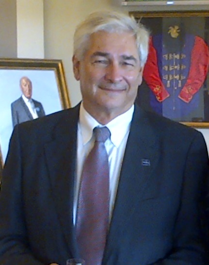
Anthony Knap
· Research ProfessorVerifiedTexas A&M University · Oceanography
Active 1979–2026
About
Anthony Knap is a Research Professor in the Department of Oceanography at Texas A&M University, within the College of Arts and Sciences. He is based in the Eller Oceanography & Meteorology Building in College Station, TX. His contact information includes a phone number (979) 458-9328 and email tknap@tamu.edu. The biography indicates his role as a research faculty member, contributing to the university's oceanography program. Further details about his specific research focus, background, or key contributions are not provided in the available page text.
Research topics
- Ecology
- Biology
- Environmental chemistry
- Oceanography
- Environmental science
- Organic chemistry
- Geography
- Chemistry
- Geology
- Toxicology
- Geomorphology
- Zoology
Selected publications
2026-04-13
articleSSRN Electronic Journal · 2026-01-01
preprintOpen accessDiagnosing coastal processes using machine learning and ocean buoyancy gliders
Limnology and Oceanography · 2025-02-05 · 1 citations
articleOpen accessSenior authorAbstract Ocean buoyancy gliders provide a comprehensive view of the water column, offering more than simply a snapshot of a single moment in time or space. In this study, we applied the established machine learning method, k‐means clustering, to a glider dataset collected in the summer of 2015 in the northern Gulf of Mexico. Clustering analysis of chromophoric dissolved organic matter and salinity revealed the physical structure of water masses, both vertically within the water column and horizontally along the shelf. Supplementary statistical analyses, including principal component analysis and ANOVA, of individual clusters confirmed the clusters were statistically distinct from one another and provided insights into the factors contributing to their differentiation. The clusters identified in the glider dataset represent water masses variously distinguished by river plumes, wind‐induced upwelling effects, shifts in currents, density‐induced stratification, and biological processes. This study demonstrates that applying machine learning clustering methods to subsurface glider data is a novel technique that enhances the analytical capabilities of both glider and other oceanographic datasets.
Impacts of Hurricane Harvey on Coastal Ocean Carbonate Chemistry
SSRN Electronic Journal · 2025-01-01
preprintOpen accessMarine Technology Society Journal · 2025-01-23
articleAbstract We report the preliminary results of the international MASTR (Mini-Adaptive Sampling Test-Run) Experiment under the UGOS (Understanding the Gulf Ocean Systems) Program. The experiment utilized cutting-edge ocean observing technologies, including autonomous platforms, moorings, aircraft, and high-frequency radar, to collect near‐real-time temperature, salinity, and velocity observations in the southeastern Gulf of America and Yucatan Channel. These observations provided critical insights into the complex dynamics of the Loop Current (LC) and its associated eddies, which influence regional circulation and operational predictability. Six ocean buoyancy gliders were deployed in the western Yucatan Strait near Mahahual, México. Four gliders were deployed from January to April 2024; and two, from July to November 2023. The high-frequency radar system near Cancun, México, operational throughout the experiment, observed surface velocity patterns and extreme weather events, including Hurricane Idalia (August 26 to September 2). Radar data captured the spatial and temporal position of the Yucatan Current speed core and revealed the LC system's evolution from a retracted state. Observations exposed the complexity of the LC system, influenced by topographic, tidal, geostrophic, ageostrophic, and wind forcing. Nearly 3,900 temperature and salinity profiles were collected, significantly improving LC and hurricane intensity forecasts. Integrating near‐real-time observations into federal and industry models enhanced forecast accuracy. This experiment underscores the value of adaptive sampling in advancing regional circulation understanding and operational forecasting. Findings will inform the 2025 Grand Adaptive Sampling Experiment, support cost-effective observing systems, and improve offshore risk management and hurricane predictions.
Real-Time Optimal Planning and Adaptive Sampling for Multi-Platform Operations in the Gulf of Mexico
2025-09-29
articleIn this paper, we use our MIT Multidisciplinary Simulation, Estimation, and Assimilation Systems (MSEAS) including Error Subspace Statistical Estimation (ESSE) largeensemble forecasting to provide real-time probabilistic forecasts for the Gulf of Mexico during the collaborative GRand Adaptive Sampling Experiment (GRASE) from April to September 2025. These forecasts are used for optimal planning and adaptive sampling for multiple platforms deployed during the experiment. We highlight real-time forecasts for probabilistic glider reachability and optimal planning. We showcase mutual information forecasts for optimal adaptive sampling with gliders and floats, maximizing information about the Loop Current (LC) and its eddies (LCEs). We showcase reachability and flow map forecasts for floats, characterizing water mass transports and eddy filamentations. We present probabilistic LCE forecasts using clustering techniques. Finally, we guide two gliders to recovery points using reachability and heading forecasts.
2025-09-29
articleThe Yucatan High Frequency Radar (HFR) Network is a trilateral collaboration between the U.S., Mexico, and Cuba designed to monitor surface currents in the Yucatan Channel, a critical segment of the Atlantic Ocean conveyor belt. Two long-range CODAR SeaSonde systems were installed on Isla Contoy and at UNAM's Puerto Morelos facility to provide sustained, near-real-time observations of the Yucatan Current, which feeds the Loop Current and impacts hurricane intensification and climate variability. A key innovation is the use of Automatic Identification System (AIS) ship-tracking data to continuously calibrate receiver antenna patterns, eliminating the need for traditional on-water calibration. Hourly surface currents are processed, quality-controlled using QARTOD standards, and publicly distributed via an ERDDAP server. A derived velocity transect product along the strait's axis is used to analyze flow variability and validate ocean models, which often misrepresent the spatial structure observed by HFR. During the 2024 Mini-Adaptive Sampling Test Run (MASTR), real-time radar products supported autonomous vehicle missions and targeted ship sampling. Expansion to Cuba and additional Mexican sites is underway, positioning the network as a foundation for Caribbeanwide HFR coverage under GOOS and TAC-OOFS to improve ocean forecasting and hurricane prediction.
Ocean Current Affairs in the Gulf of Mexico
Eos · 2025-05-19
articleOpen accessSenior authorMultinational and multidisciplinary studies of the past and present of the Gulf’s Loop Current are helping to reveal what might be in store for coastal communities.
Journal of Geophysical Research Oceans · 2025-04-01 · 1 citations
articleOpen accessSenior authorAbstract A previously uninvestigated necking‐down region in the Gulf of Mexico, associated with the Loop Current eddy (LCE) separations is defined by the 8–16 days variance below the Loop Current system (LCS) around 88.5°W, using an Ocean‐Atmosphere Coupled Regional‐Community Earth System Model (R‐CESM) 9‐year nature run, which reveals the mechanisms of Loop Current (LC) deep dynamics. Scaled wavelet analysis of flow fields in five regions at the 27.5 kg/m 3 potential density layer under the LCS shows that the 8–16 days variance is reproduced by the R‐CESM model dynamics, aligning with in situ observations. This weather band deep variance, identified as the mixed waves located between the mixed Rossby‐gravity waves and Rossby waves in the ocean wave dispersion relationship, is stimulated by the interaction between the penetrating LC and steep topography. Then, these waves are released from the constraints of the topography and become free wave trains. There are three critical regions for the propagating wave trains: the Mississippi Fan, the Yucatan Shelf, and the Florida Escapement. The various wave trains define five distinct scenarios: East Yucatan Shelf (EYSS), West Yucatan Shelf (WYSS), west Florida escarpment (WFES), Mississippi Fan (MFS), and quiescent (QS) scenarios. The scenarios passing through the west necking‐down region can be used to indicate the LCE separations. After the separations, the retracted LC may encounter interference from either the EYSS or the WFES, preventing the reattachments. These 8–16‐day waves offer insights into describing the LC shedding events from the lower layer of the LCS, enhancing the understanding of LCS dynamics.
Offshore Technology Conference · 2024-04-29 · 3 citations
articleAbstract We report the preliminary results of the international MASTR (Mini-Adaptive Sampling Test-Run) Experiment of the UGOS (Understanding the Gulf Ocean Systems) Program, which simultaneously deployed multiple autonomous measurement platforms (i.e., ocean buoyancy gliders, subsurface floats, surface drifters) and high-frequency coastal radar in the Deepwater south-eastern Gulf of México. The state-of-the-art ocean observing technologies provide near-real-time surface and subsurface co-located temperature, salinity and velocity observations and were assessed for improvements to the predictive capability of multiple federal and industry operational ocean circulation models. Six ocean buoyancy gliders were deployed in the western Yucatan Strait near Mahahual, México - four of the gliders were deployed in January 2024, two gliders were deployed from July thru November 2023. The summer and fall 2023 glider data was assimilated into the NOAA RTOFS numerical model and significantly improved the model performance to accurately represent the vertical hydrographic structure of the inflowing water from the Caribbean Sea to the Gulf of México via the Yucatan Strait. The high-frequency radar system deployed near Cancun, México was operational throughout the experiment. Radar observations of surface velocity during fall 2023 observed the passage of extreme weather events, including Hurricane Idalia (26 August – 2 September). Additionally, the hi-frequency radar observed the spatial and temporal position of the Yucatan Current speed core as the Loop Current System in the Gulf of México evolved from a retracted state to an extended state, to a detached state, with numerous reattachment sequences. The research underscores the complexity of the four-dimensional structure of the Loop Current system and the spatial and temporal evolution of the circulation in response to topographic, tidal, geostrophic, ageostrophic, and wind forcing. Additional observations from airborne and subsurface observational platforms reveal sub-mesoscale variability and the correlation between surface and subsurface current patterns.
Recent grants
Frequent coauthors
- 32 shared
Anthony F. Michaels
- 30 shared
Steven F. DiMarco
Texas A&M University
- 29 shared
Terry L. Wade
- 23 shared
Antonietta Quigg
Marine Conservation Institute
- 20 shared
Nicholas R. Bates
Bermuda Institute of Ocean Sciences
- 18 shared
Rodney J. Johnson
- 18 shared
Richard E. Dodge
Nova Southeastern University
- 17 shared
Gopal Bera
- Resume-aware match score
- Save to shortlist
- AI-drafted outreach
See your match with Anthony Knap
PhdFit ranks faculty by your research interests, methods, and publications — grounded in their actual work, not templates.
- Free to start
- No credit card
- 30-second signup